


 User Center
 My Training Class
 Feedback


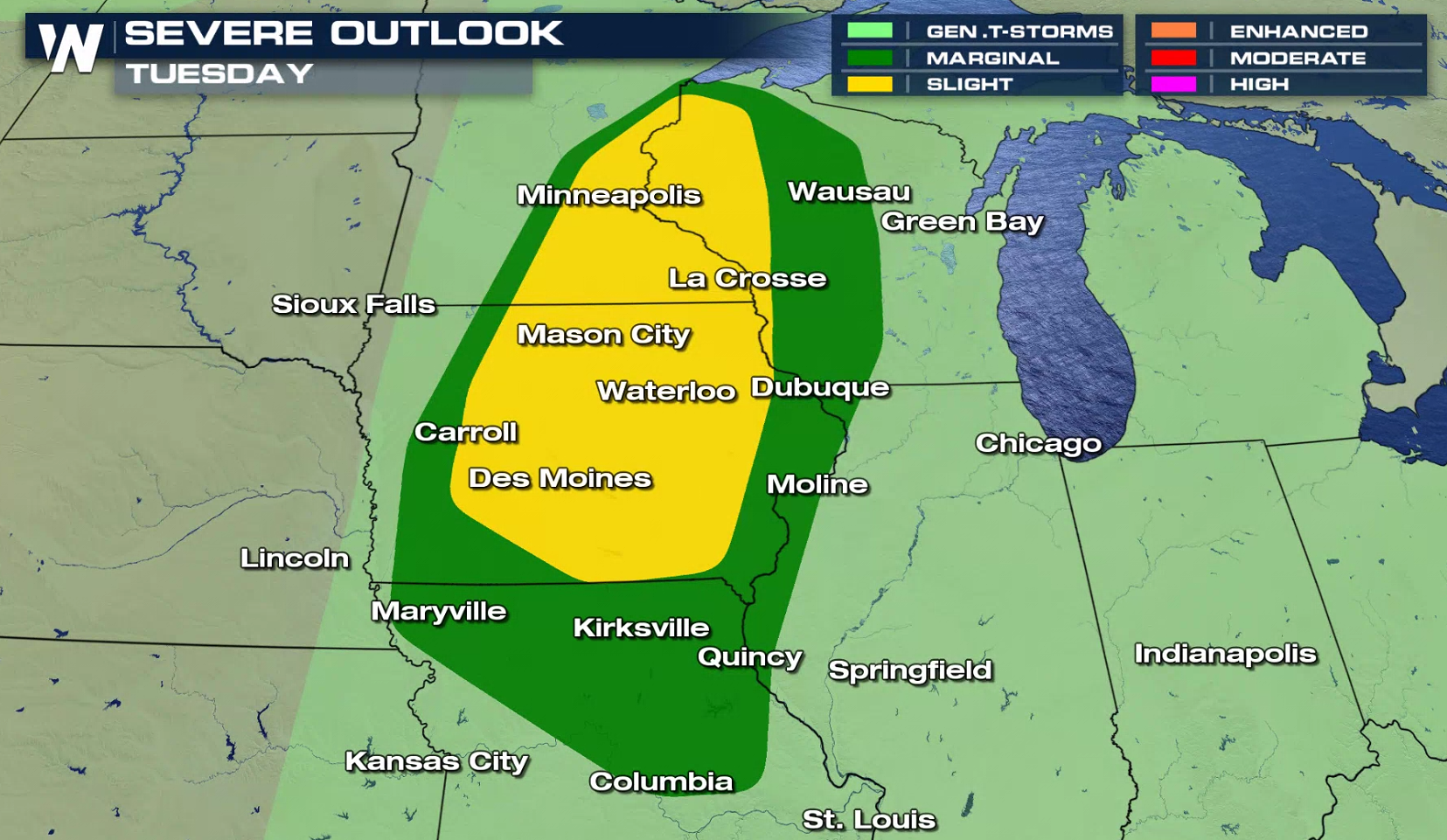
A slow moving storm system will bring the threat for severe thunderstorms into the Upper Midwest today (Tuesday). A slight risk for severe storms extends from near Duluth, Minnesota to the Iowa / Missouri border. A marginal risk extends into northern areas of Missouri, southward to Columbia.
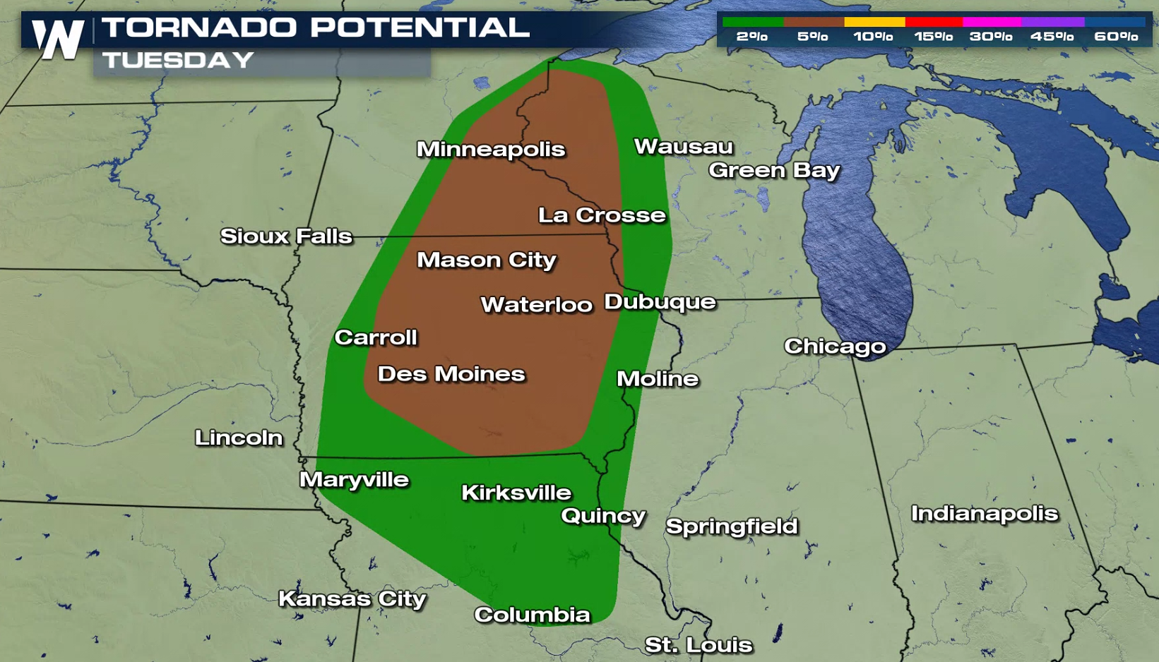
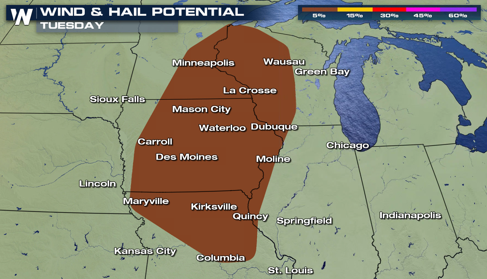
If you focus on the wind direction in the atmosphere, notable low level wind shear is present. The direction the wind is flowing from changes with height as you move from the surface to a few thousand feet high. This will support the development of a few supercells in late afternoon and evening. Tornadoes, large hail, and strong wind gusts are all possible with ample instability and energy over the region.
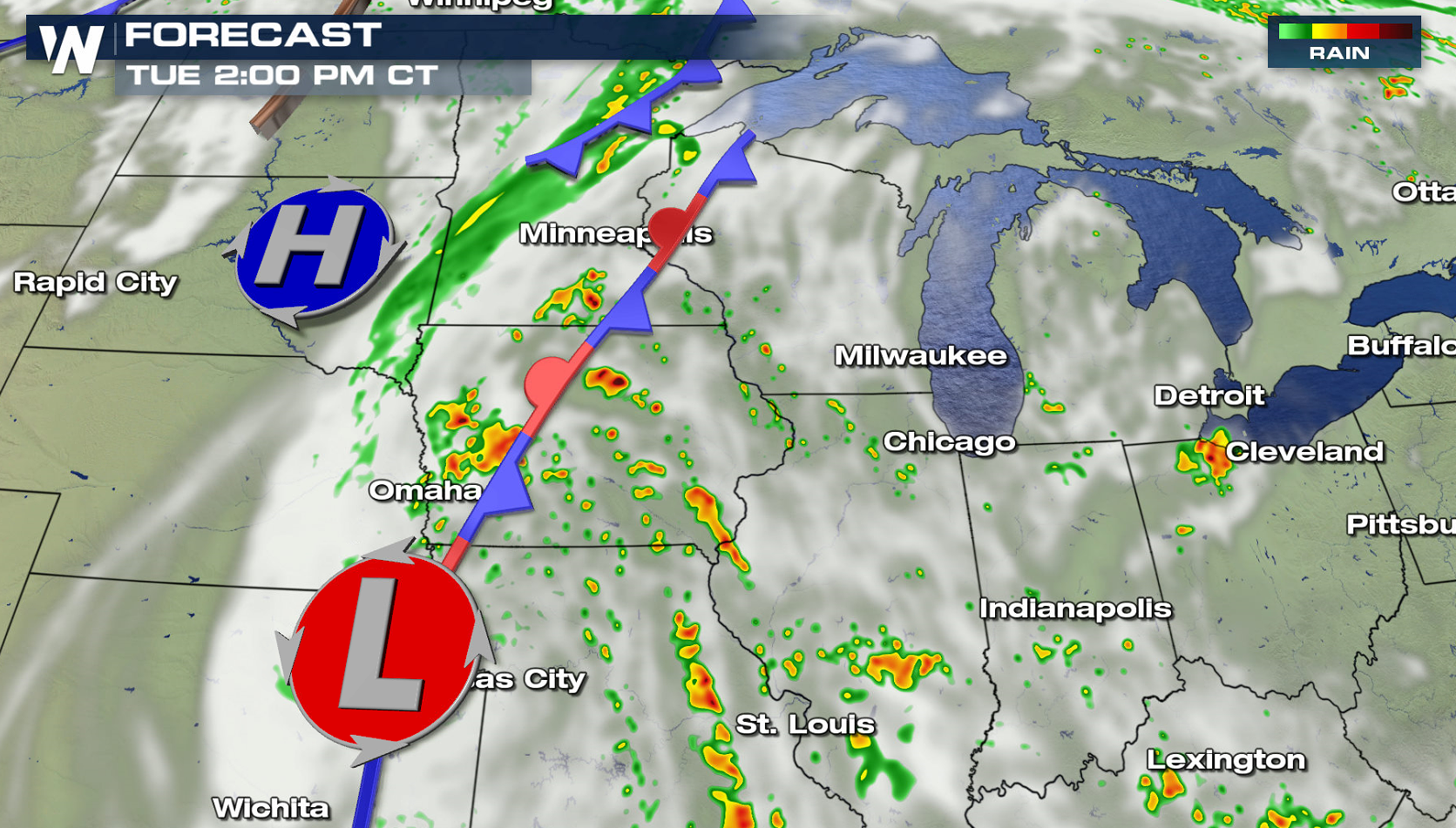
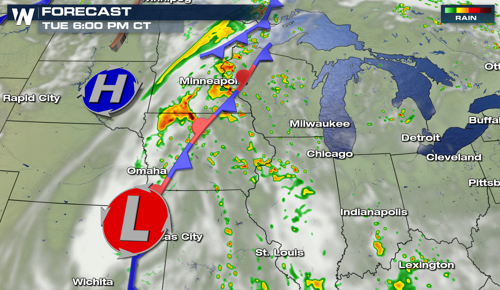
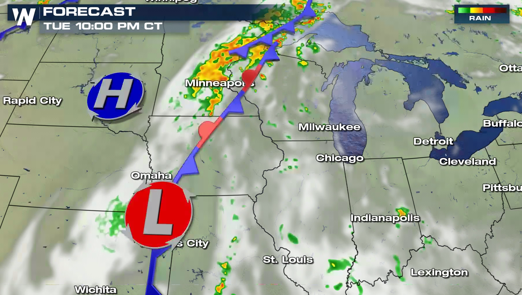
If you are in the risk areas, check back with WeatherNation throughout the day for forecast updates and alerts on-air and online.


Comments
Something to say?
Log in or Sign up for free