


 User Center
 My Training Class
 Feedback


Gulf Low to Bring Heavy Rain to Gulf Coast, Could Develop into a Tropical System

A slow moving tropical wave is expected to bring heavy rain to the Gulf Coast into the weekend, but could develop into a tropical system, potentially complicating forecasts or leading to greater impacts. This tropical wave has already brought multiple days of heavy rain to the Sunshine State, with trailing moisture potentially continuing heavy shower activity across the peninsula in the days ahead.

The National Hurricane Center is currently monitoring the tropical wave, a broad band of showers and thunderstorms, as Invest 91, and gives the storm a high chance to develop into a tropical depression through Saturday, when it is expected to be moving into Texas.

A large ridge of high pressure centered over the Southeast will continue to steer the tropical wave to the west-northwest, with most models hinting at a closed low moving onshore along the Central Texas coastline on Saturday.

Warm sea surface temperatures in the Gulf of Mexico and light to moderate wind shear should lead to a favorable environment for gradual strengthening over the next several days.
Forecast
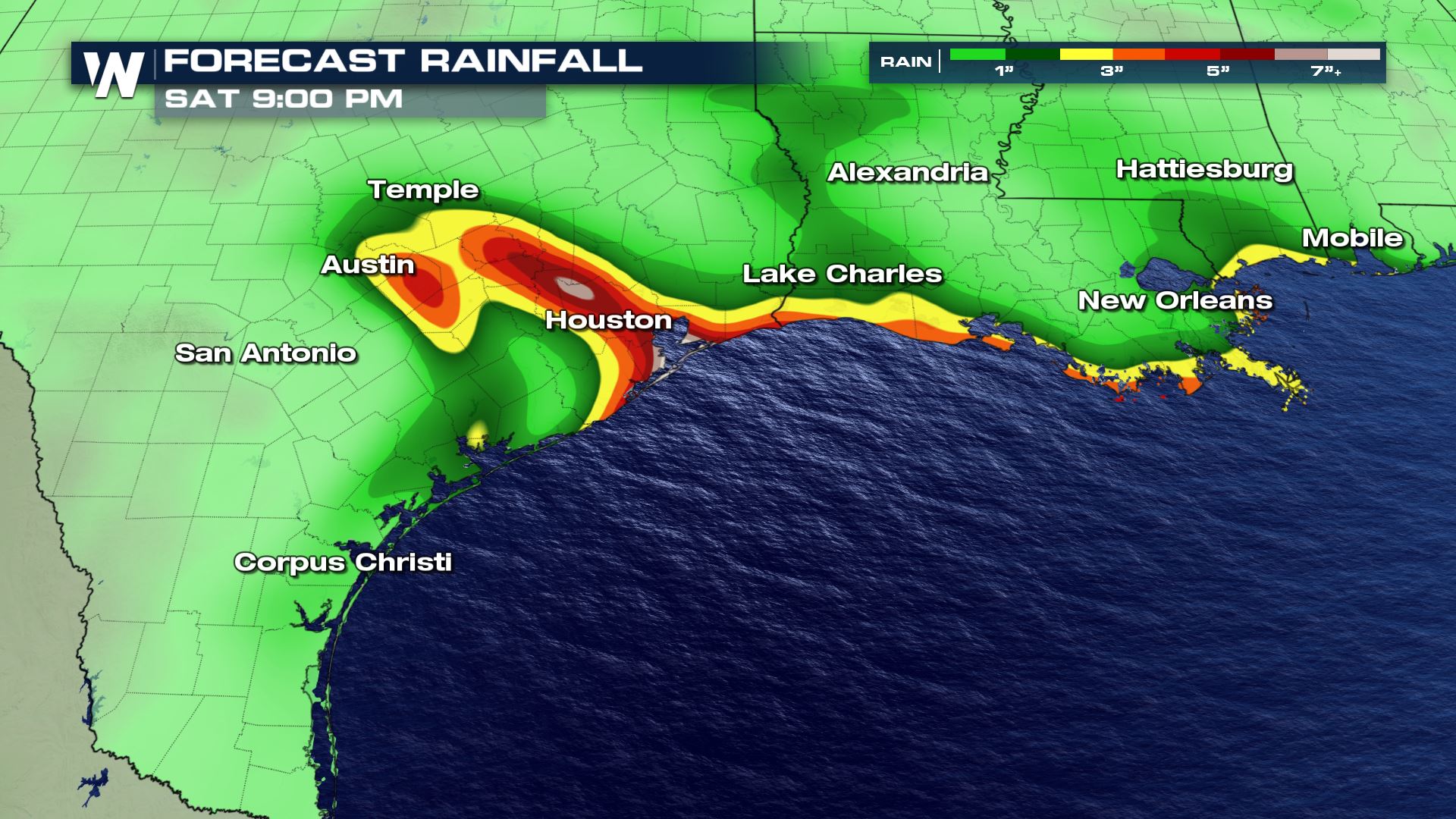
Regardless of development, Invest 91 is expected to bring moderate to heavy rain along the northern Gulf Coast and into Texas from Thursday into the weekend. The National Hurricane Center also expects “fresh to strong” winds in the gulf, which roughly translates to 20-30 miles per hour.

Several inches of rain are expected from Mobile, Al to the Central Texas Coastline. Areas north of the storm’s circulation could see higher totals, with the potential for flooding, coastal flooding, and/or flash flooding a concern that will need to be monitored over the next several days.
Stay with WeatherNation on air and online for the latest updates on the tropics. This article will be updated as new information becomes available.


Comments
Something to say?
Log in or Sign up for free