


 User Center
 My Training Class
 Feedback


A cold front sweeping through the South Friday-Saturday will bring storm chances in addition to a big cool down for many. Here is the latest forecast.
Setup
Ahead of the frontal passage Friday there will be ample moisture streaming up from the Gulf. This will help in storm development in addition to providing the possibility for heavy downpours. As of now the Weather Prediction Center has not marked any regions for excessive rainfall associated with this system.

Not only will there be ample moisture but we are also expecting to see building instability ahead of the front. This energy (CAPE) will allow for some isolated thunderstorms ahead of the system. Although right now the Storm Prediction Center has not marked any region for possible severe weather, it’s still important to check back later as the forecast can change.

Timeline
By early Friday morning we are already expecting to see cloud cover and showers through a good portion of Oklahoma and Central Texas ahead of the system.

As the low moves it way East through Oklahoma we can start to see some winter weather in the Oklahoma panhandle around lunchtime. We can also start to see some more heavy downpours, in addition to isolated storms along the OK/AR border and in Eastern Texas.

It is possible we can see some stronger thunderstorms Friday night. On the map below you can see the dark red and orange colors on the forecast radar, which would indicate some robust storms rolling through locations including Shreveport LA.

The cold front will continue to push East during the day on Saturday and as it does it will bring more wet weather, with some isolated thunderstorms possible.

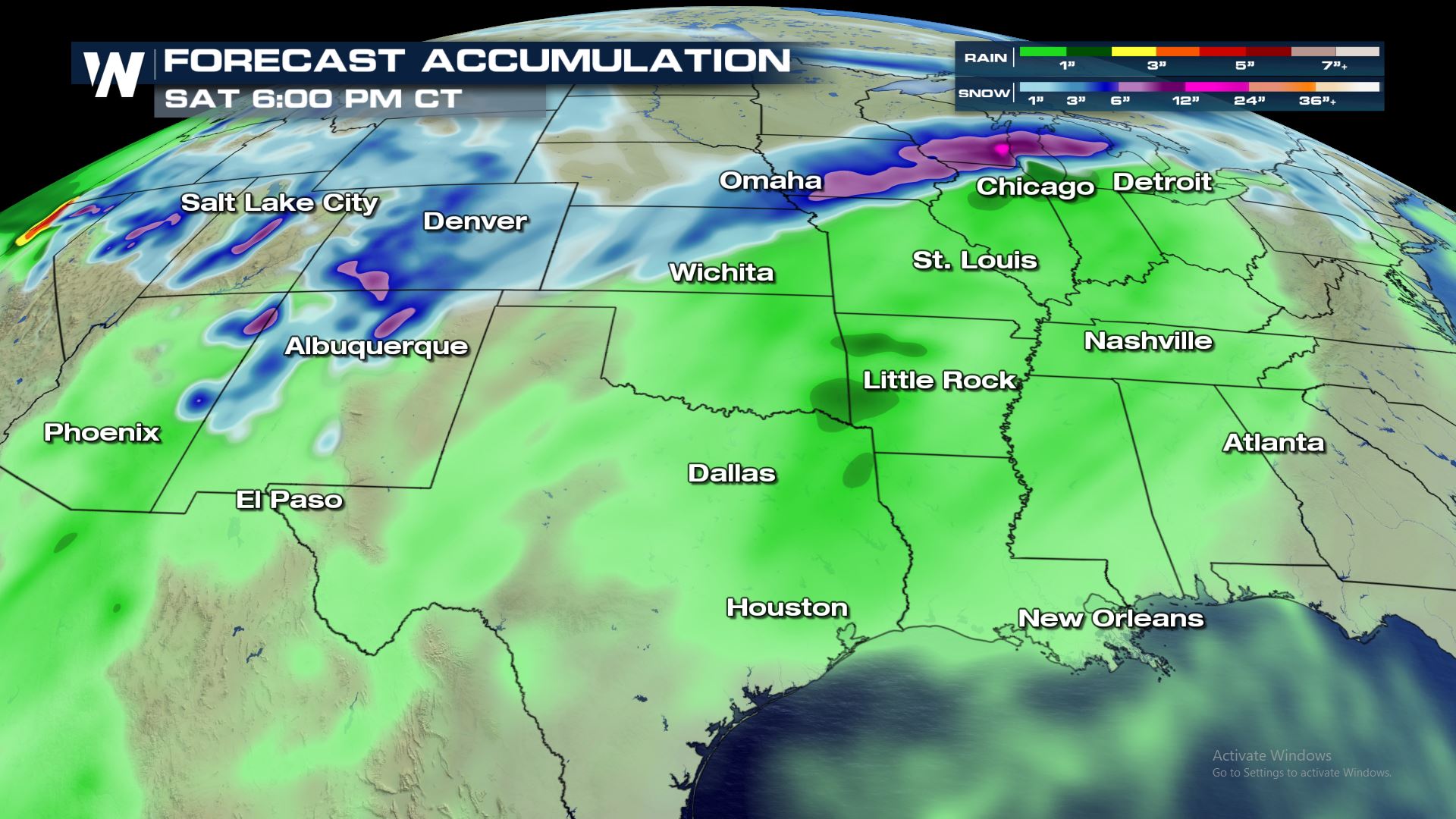
Because this frontal system is expected to move quick right now rainfall totals keep most accumulations under an inch. It is important to note that we can quickly get several inches of rainfall from systems like this if there’s a thunderstorm.
Temperature Trend
After the system moves through temperatures will be cooler for many! Indianapolis will go from temperatures in the 50s (about 10-15° above normal) to temperatures topping out in the 30s to start next week.

Little Rock will also see a noticeable temperature drop behind the system with their high on Thursday being nearly 30° warmer than the high on Sunday of 44°.

Although not quite as dramatic of a temperature fall, Houston will certainly feel much cooler going into next week. Space City will be waking up in the 30s both Monday and Tuesday so get those big coats ready!


Comments
Something to say?
Log in or Sign up for free