


 User Center
 My Training Class
 Feedback


New Year’s Eve System to Bring Precipitation to the South

As we track the forecast of a Pacific system moving into the Central United States (see here for details) through Tuesday and Wednesday, an additional low pressure system dives off of this system and brings the chance for precipitation across Texas and Oklahoma. By Wednesday, the upper level low that is energizing storms moves over New Mexico/Texas.

By New Year’s Eve, this upper level low moves over Texas and Oklahoma and brings all sorts of active weather, from snow to ice to even strong storms heading into the Gulf States.

Focusing on the precipitation aspect of this forecast, there are still a few discrepancies to work out in the models. As we collect better model data to initialize these storms we will have a clearer picture of who sees ice and snow and who sees heavy rain. So lets’ take a look at the early data and who has the best potential to see impacts.
An Early Look At The Forecast
The forecast model we’re using here is our in-house Baron Model. As a surface low moves in Wednesday, Gulf moisture and the addition of some Pacific moisture in the upper levels of the atmosphere will help bring in precipitation. Behind this frontal boundary, a big mass of cold air will run into a clashing warm air mass and this contrast along the frontal boundary is what helps elevate storms. Behind the front, some precipitation has the likelihood of transitioning to some freezing rain and ice.

By Wednesday evening, west Texas from Amarillo through Lubbock and into El Paso likely will have cold enough air to support snowfall. Even up through central Oklahoma may pick up on some snow chances.

By early Thursday morning, with all the moisture wrapping around the low pressure system from the Gulf we continue to fuel heavy rain through Central Texas and along the stalled out front some may see some excessive and heavy rain. On the back side, ice and snow for west Texas.

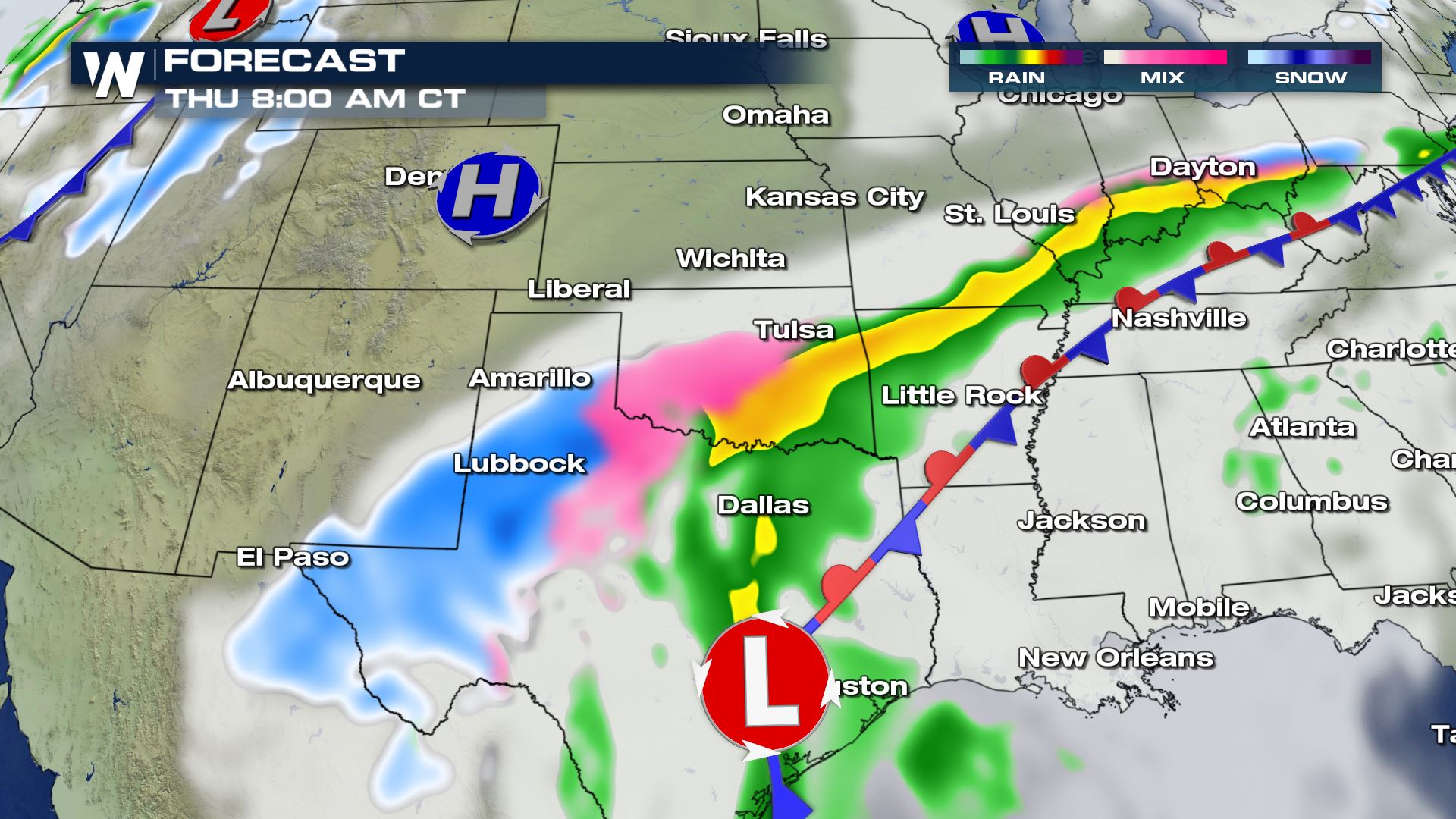

By New Year’s Eve as temperatures start to drop when we lose daytime heating the chance for more freezing rain moves into Oklahoma and Missouri as surface temperatures begin to drop. The Texas/Oklahoma panhandle continues to see snow.


There is still some uncertainty of the timing of this system but the big picture low pressure system will definitely bring a change in temperatures to the south-central United States as we ring in the New Year.

Where the freezing line moves in will determine what type of precipitation we will get.
Precipitation Location
Since it is still a little too early to show exact locations of where the heavy rain and snow is expected here is a look at where our forecast models show the best chance for our rain, ice and snowfall chances.

Central Texas is likely to see several inches of rain where west Texas and the panhandle have better chances for wintry weather. For the latest forecast, be sure to tune into WeatherNation.


Comments
Something to say?
Log in or Sign up for free