


 User Center
 My Training Class
 Feedback


Severe Storms Over the Southern Plains Pose a Flood Risk Too

As a weaker end variety system dropping through the Rockies from north to south interacts with a system embedded within the subtropical jet stream, a series of complexes of storms will continue to fire up each evening over the next few days. These mesoscale convective systems, or MCSs will drop heavy amounts of rain over the Southern Plains into Midweek. Plenty of humidity from the Gulf of Mexico will be available priming the atmosphere for these heavy rain events.

ALERTS
Right now, there are a number of flash flood and areal flood watches in effect through at least Monday (Memorial Day) night.

OUTLOOKS
The Weather Prediction Center has outlined these areas over the next 3 days where flooding is the likeliest to occur.


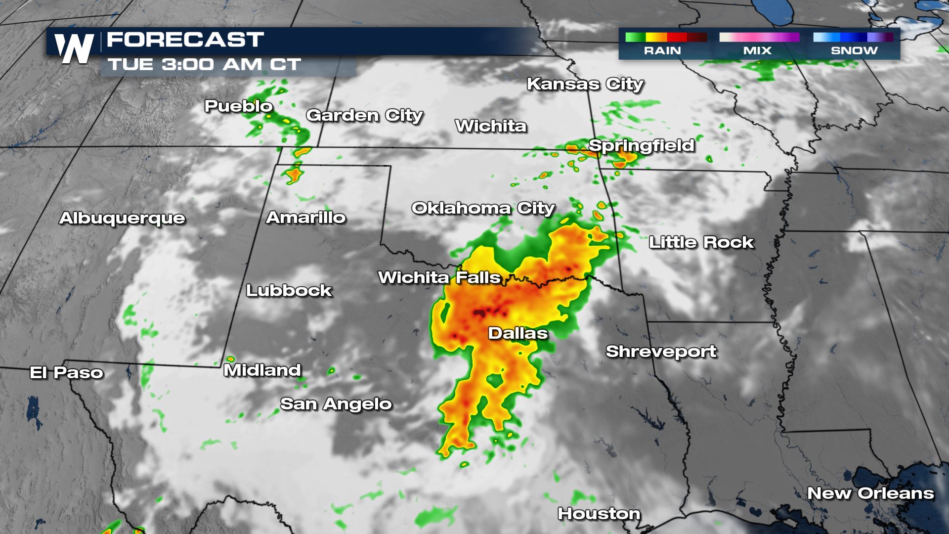
FORECAST
According to our local data, storms are expected to fire up in the prime heat of the day in the afternoon hours. As the storms strengthen, they’ll grow in areal coverage and congeal into a complex of storms. This is where the heavy rain threat will be maximized and where the storms are more likely to deliver the most prolonged duration in the overnight hours.


AMOUNTS
Our local data is forecasting some spots where over 7″ of rain could be possible over the next 48 hours!
Stay with us on WeatherNation for all the latest on this particular weather event!


Comments
Something to say?
Log in or Sign up for free