


 User Center
 My Training Class
 Feedback


Heat, Rain & A Cool Down For The Northeast

The northeastern United States has been feeling the summertime heat the last few days. Through tonight, heat advisories remain in place across the east coast. What we call the ‘urban heat island’ will continue to affect the metros of Philadelphia and Boston will keep the heat going through this afternoon. BUT with hot temperatures, this will help bring instability for summertime storms. Let’s take a look at the forecast:
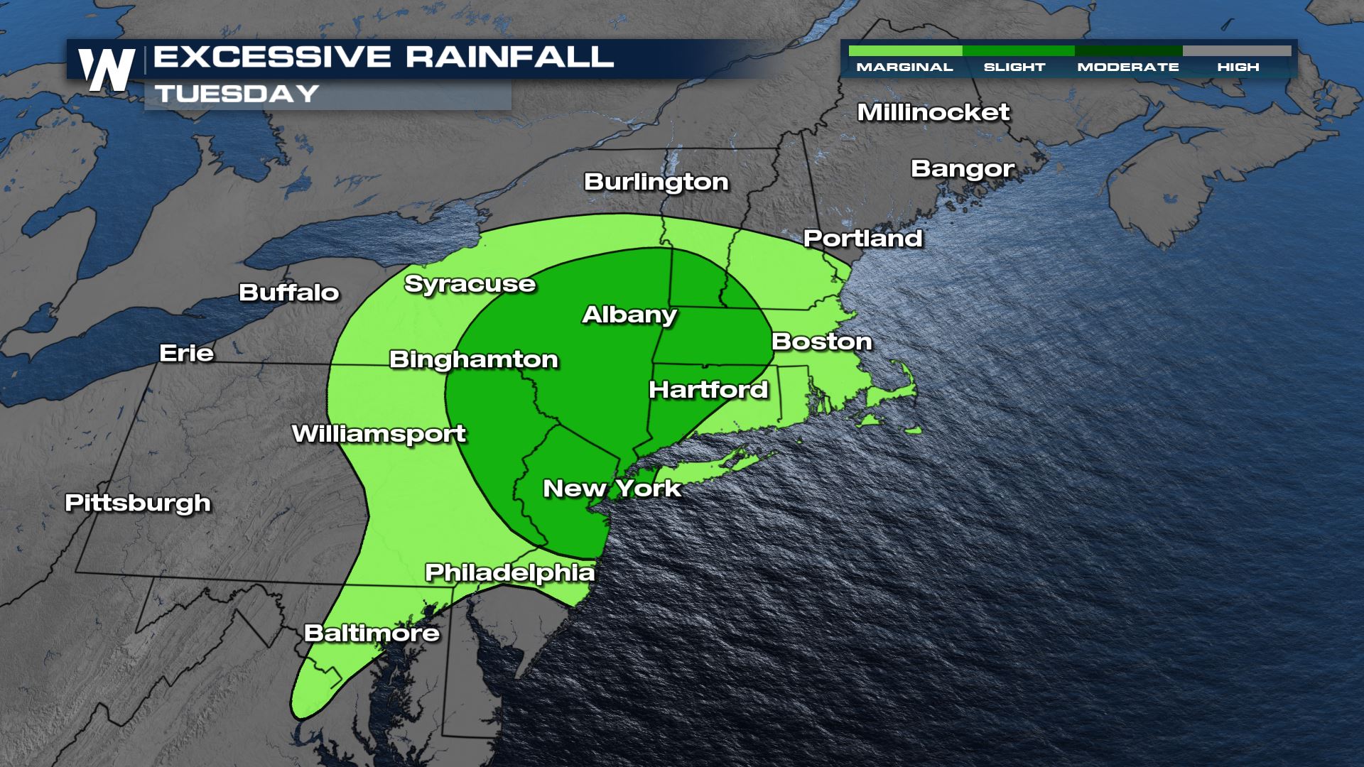
Tuesday
Heat
So far, cities like Boston have already reached the mid-90s. The I-95 corridor will continue to see heat indices in the mid to upper 90s before the rain brings a change to that.

Heat advisories remain in place for the aforementioned cities like Boston, Providence, and Philadelphia through tonight.

Rain & Thunderstorm Outlook
Through tonight, the Storm Prediction Outlook has many portions of the northeast under a marginal risk for strong to severe storms. This is a level 1 on a scale that goes up to 5 for primarily strong, damaging wind gusts. Microbursts will be possible on a very isolated basis. Otherwise, flooding and lightning will be a bigger concern.

Storms have already been popping across the upper Ohio Valley and into the northeast but through tonight we will continue to see this batch of rain and thunderstorms moves into the Atlantic.


As we lose daytime heating the threat for storms comes to an end and flooding will be a greater concern. That is why the Weather Prediction Center has issued a slight risk for excessive rain and the National Weather Service has issued flash flood alerts.
Flash Flood Watches remain in effect through tonight for an additional 2-4″ of local rainfall totals.

Wednesday – Thursday
Rain & Thunderstorm Outlook
Once the rain starts to move in, temperatures will begin to cool across the northeast. Scattered thunderstorm activity will still be possible as a low pressure system moves in and flooding will be possible. By Wednesday and Thursday afternoon, the prime of daytime heating is when we will have the most instability for thunderstorms.

A triple point will form into Thursday afternoon bringing the risk for additional strong thunderstorms. Right now there is no severe weather outlook but be sure to keep an eye on these thunderstorms.


Once the low moves in the heavy rain may prompt flash flooding.

Temperatures
With rain in store, temperatures are forecast to drop from the 80s and 90s down to the 70s out east by the end of the week.


For the latest details on the northeastern forecast be sure to tune into WeatherNation every 10 minutes past the hour or search for your ‘Eastern Regional’ forecast in the searchbar!


Comments
Something to say?
Log in or Sign up for free